UN
12 Poplar Road
£ 750
Description
We don't have a Description for this property.
- Bedrooms
- 3
- Bathrooms
- 0

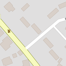

Leaflet © OpenStreetMap contributors
The heatmap indicates the level of crime in the area. The color of the heatmap indicates the crime severity and recency.
Metrics Year-on-Year
- Average area value
- 257,097.00 £Decreased by 8.25 %
- Average area rental value
- 956.00 £/moIncreased by 1.92 %
- Est rental Yield
- 4.46 %Increased by 10.95 %
- Crime Rate
- 60.00 %Unchanged by 0.00 %
from 280,201.00 £
from 938.00 £/mo
from 4.02 %
from 60.00 %
Nearby Schools
| Name | Type | Ofsted | Distance |
|---|---|---|---|
| Wittersham Church Of England Primary School | Voluntary Aided School | Good | 0.69 KM |
| Peasmarsh Ce Primary School | Children's Centre Linked Site | 5.20 KM | |
| Peasmarsh Church Of England Primary School | Voluntary Controlled School | Good | 5.23 KM |
| Tenterden Infant School | Academy Converter | Good | 6.18 KM |
| Tenterden Church Of England Junior School | Academy Converter | Good | 6.23 KM |
Images
Nearby Streets
| Name | Average Price | Average Sqft | Distance |
|---|---|---|---|
| Owens Close | £ 0 | 0 | 0.00 KM |
| Acton Lane | £ 0 | 0 | 0.00 KM |
Nearby Transport
| Name | NLC | TLC | Distance |
|---|---|---|---|
| Rye (Sussex) | 5024 | RYE | 7.34 KM |
| Winchelsea | 5042 | WSE | 8.97 KM |
Nearby Listings
| Address | Price | Type | Score | Distance |
|---|---|---|---|---|
| Forge Meads, Wittersham, Tenterden | £ 315,000 | BUY | 7 / 10 | 0.09 KM |
| WITTERSHAM | £ 395,000 | BUY | 7 / 10 | 0.13 KM |
| The Street, Wittersham, Tenterden, Kent, TN30 | £ 2,250,000 | BUY | Unknown | 0.20 KM |
| The Street, Wittersham, Tenterden | £ 550,000 | BUY | 6 / 10 | 0.20 KM |
| The Street, Wittersham, TN30 | £ 650,000 | BUY | Unknown | 0.22 KM |
Nearby Properties
| Address | Price | Distance |
|---|---|---|
| 12 Poplar Road | £ 750 | 0.00 KM |
| 14 Poplar Road | £ 290,000 | 0.00 KM |
| 10 Poplar Road | £ 345,000 | 0.00 KM |
| 16 Poplar Road | £ 245,000 | 0.00 KM |
| 1 Forge Meads | £ 190,000 | 0.08 KM |